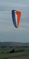
During the first task of the club comp at Model Ridge we had to fly down to Hasty Bank and cross the road before returning back to take off. This I did as did others. But!!! When looking at the IGC file on the club XC page the trace was short of the road?? I knew I had not only crossed the road but flew well past it. I started to doubt myself and couldn't argue with the trace. Talking to Ian yesterday he mentioned about looking at the flight in Google earth which I've just done tonight and yes it shows the correct trace which is way past the road.
So it appears that there can be "small" inaccuracies a point indeed to look out for.
If you check the link below and first click the IGC file and zoom in you will see the flight is short of the road. Then go back and view the file in Google Earth and you will see the trace is well past the road.
Interesting.
JW
http://www.nhpc.org.uk/nhpc/modules.php ... ghtID=3450
IGC and Google Earth and GPS and Inaccuracies
Moderator: Club Moderators
-
John Wallis
- Seasoned
- Posts: 4072
- Joined: Tue Dec 20, 2005 7:17 pm
- Location: Northumberland
IGC and Google Earth and GPS and Inaccuracies
Livetrack24 wannyjollis
“If you always do what you’ve always done, you’ll always get what you’ve always got.”
“If you always do what you’ve always done, you’ll always get what you’ve always got.”
-
colin keightley
- BHPA Club Coach

- Posts: 2492
- Joined: Fri Oct 12, 2007 5:22 pm
- Full Name: Colin Keightley
- Location: Stockton
- Contact:
-
dave-mclaughlin

- Chatty
- Posts: 245
- Joined: Wed Dec 21, 2005 12:01 pm
- Location: Teesside
- Contact:
Strange. When I looked at the trace using google earth it came up slightly short of the Clay Bank road. When measured using the 'ruler' button, you came up short by about 50ft.
I'm using Google Earth version 4.3.7284.3916 (beta).
Thought at first it could be GPS datum problem, but the IGC file says you're using WGS84, which is correct.
I'm guessing it's all down to the accuracy of the GPS device, how Google Earth interprets its positional data, and the accuracy of the models used to convert data from one GPS format to another - there's some complicated maths involved under the covers.
Have a look at:-
http://www.ordnancesurvey.co.uk/oswebsi ... uide3.html for a flavour of what google earth is doing!!
No, I didn't understand it either!
Dave McLaughlin
Homo Sapiens Non Urinat In Ventum
Homo Sapiens Non Urinat In Ventum
-
John Wallis
- Seasoned
- Posts: 4072
- Joined: Tue Dec 20, 2005 7:17 pm
- Location: Northumberland
Hi Dave do you think screen resolution could have anything to do with it? Looking at it again for the second time in Google Earth it also looked a tadge short, then the third time it was well passed the road where I actually got to.
Just in case anyone thinks I'm moaning about whether I've crossed the road or not I'm not in the slightest (I know I did that's not the point I'm making) The point I'm making is a GPS doesn't seem to be the be all and end all of where you actually made it to.
One thing that was mentioned last week was GPS sample rate I think mine is set quite high????
P.S.Dave Maths was never a strong point and felt sick trying to understand that link.
Livetrack24 wannyjollis
“If you always do what you’ve always done, you’ll always get what you’ve always got.”
“If you always do what you’ve always done, you’ll always get what you’ve always got.”

I've checked this on a number of flights in a number of destinations. They all seem to vary by a constant inconsistency. One comparable factor to the inconsistencies seems to be the geometaphysical consistency of the underlying rock mass. It seems that rocks from the dylurian epoch, such as those found further to the north seem to effect the GPS trace less than those from the sedimentary post dylurian era such as those within the vicinity of lesser volcanic areas. And if you've read this and believed it so far, you're dafter than I look. Great day for prophesying though isn't it?
See you out there!!!!!
Surf crazed and dazed
Livetrack24 Nezzy01
Surf crazed and dazed
Livetrack24 Nezzy01
-
colin keightley
- BHPA Club Coach
- Posts: 2492
- Joined: Fri Oct 12, 2007 5:22 pm
- Full Name: Colin Keightley
- Location: Stockton
- Contact:
-
ron freeman
- Seasoned
- Posts: 3147
- Joined: Wed Dec 21, 2005 10:50 pm
- Full Name: Ron Freeman CFI
- Location: Cheviot hills, Northumberland
Cylinder route
Colin, better to go the '400m cylinder' (entered waypoints) instead of using the GPS for a micky mouse trail.... it does looks nice but as you say its not accurate.
Maximise your time & dosh do both Hanggliding & Paragliding ")

John, I see you are using a flytec 5020 same as me
It's got plenty of track memory and I have found that a good compromise for sampling rate is 3 seconds. Plenty of flying hours recording time but much more accurate track recording so that you get a better representation of your actual track.
Plus it's better for looking at your performance in thermals (not that I've seen many of them this year )
I tend to download flights fairly regularly after flying so could set the sample rate even higher, say 1 sec, but I haven't tried playing with that to see what are the pros and cons. I suppose it might struggle recording that frequently and still running the vario, graphics etc. I might have a play next time I fly.
My 5020 has memory for 24k track log points i.e. 50+ hrs flying at 10sec intervals, so I guess yours is the same.
I know you love getting pinned and gale-hanging but I'm sure you'd need to land for a pee before 50 hours is up
Or do you have plumbing to deal with that?
It's got plenty of track memory and I have found that a good compromise for sampling rate is 3 seconds. Plenty of flying hours recording time but much more accurate track recording so that you get a better representation of your actual track.
Plus it's better for looking at your performance in thermals (not that I've seen many of them this year
I tend to download flights fairly regularly after flying so could set the sample rate even higher, say 1 sec, but I haven't tried playing with that to see what are the pros and cons. I suppose it might struggle recording that frequently and still running the vario, graphics etc. I might have a play next time I fly.
My 5020 has memory for 24k track log points i.e. 50+ hrs flying at 10sec intervals, so I guess yours is the same.
I know you love getting pinned and gale-hanging but I'm sure you'd need to land for a pee before 50 hours is up
Or do you have plumbing to deal with that?
Politics is the entertainment branch of industry.
-
colin keightley
- BHPA Club Coach
- Posts: 2492
- Joined: Fri Oct 12, 2007 5:22 pm
- Full Name: Colin Keightley
- Location: Stockton
- Contact:
Dont forget if you open the flight from the xc league into google earth the track has elevations in it so if you move around in google earth so does the apearance of the track on the ground.
Toget a true representation of your track on the ground you must in the left hand pane of google earth right click on the tracklog and then select properties. This will open a dialog box select the altitude tab and then change absolute to clamped to ground then click ok.
This will pin the track to the ground so that no matter how much you move the earth around the track doesnt change apperance on it.
If Acro was easy they'd call it Cross Country
07824 554735
Livetrack24: Colinkeightley
07824 554735
Livetrack24: Colinkeightley
-
colin keightley
- BHPA Club Coach
- Posts: 2492
- Joined: Fri Oct 12, 2007 5:22 pm
- Full Name: Colin Keightley
- Location: Stockton
- Contact:
-
John Wallis
- Seasoned
- Posts: 4072
- Joined: Tue Dec 20, 2005 7:17 pm
- Location: Northumberland
All good and interesting stuff this especially when it's howling outside. Dave H I was talking to Tony Bradly on the top of Cross Fell and he suggested the same as you...Changing the sample rate as that could have been the difference between the GPS seeing the location or not.
Colin good point. I did notice the line moving about as I zoomed or moved things in Google Earth.
Brian .....Be quiet or I will start a thread on dilithium crystals
Colin good point. I did notice the line moving about as I zoomed or moved things in Google Earth.
Brian .....Be quiet or I will start a thread on dilithium crystals
Livetrack24 wannyjollis
“If you always do what you’ve always done, you’ll always get what you’ve always got.”
“If you always do what you’ve always done, you’ll always get what you’ve always got.”

If your interested in using GPS for competitions and judging turnpoints then google earth is fun but not very accurate. I'm guessing that all these graphics come from satalite images XX km over the earths surface. In patching those images onto a WGS84 model there is not going to be a perfect matching of location (lat long) to image. It's close and damn impressive but not perfect as not all parts of the image are generated from directly above the subject.
A better (cheap) method is to look for the lat and long co-ords using GPSDump or similar and compare to a turnpoint taken off a good old fashiond map. For certain machines, as Ron says, cyclinder tps can be programmed in and the GPS set up to record and signal each leg completion. You will then need some fancy software to confirm the pilots trace......
Are the NHPC are interested in GPS comps and indeed introducing these types of systems to pilots wanting to move on to bigger comps? If so then perhaps consider investing in a licence for a full task scoring software (no idea how much $$$$$$$$). Simon Raven is a bit of an expert on these things and also the problems associated with GPS. All this might be a bit OTT for the NHPC Club Champs though!
There was an article in Skywings a couple of months back talking about problems with altitude data. I fell foul of that one when I got DSQd in the BPC this year!
-
John Wallis
- Seasoned
- Posts: 4072
- Joined: Tue Dec 20, 2005 7:17 pm
- Location: Northumberland